Our weather will be sunny, dry and warmer as we head toward the weekend. Today will be sunny with high temps ranging from the upper 60s to low 70s and that trend will continue through the rest of the week. Our average high for this time of year is in the upper 60s, so we will be at or slightly above average for the next few days.
The weekend will be partly cloudy with highs holding steady in the 70s. Scattered showers and thunderstorms are possible by late Sunday into Monday.
If you’re not quite ready for fall yet, don’t worry. Our long-range models are hinting that there will be more warm (I might even be tempted to use the word ‘hot’) weather that lasts into next week and beyond. That’s still more than a week away, so stay with me for updates.

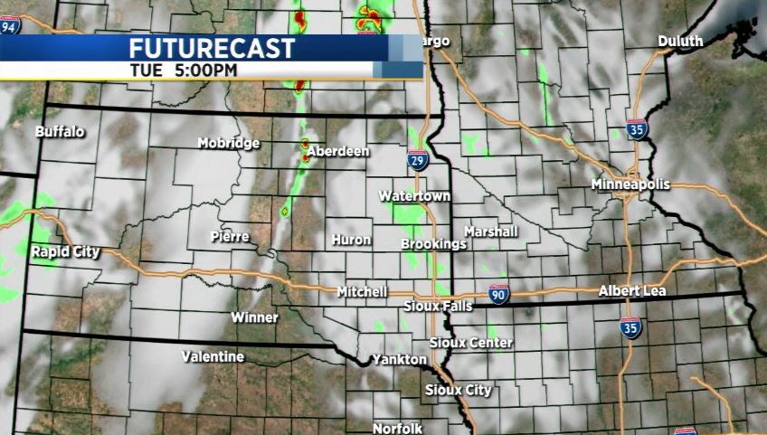
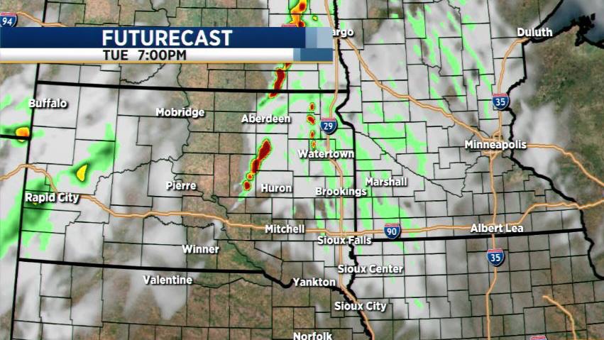
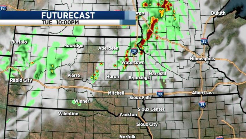
Tuesday 12Z Futurecast RPM Model Run
Here’s the latest Fururecast model run as of noon Tuesday.
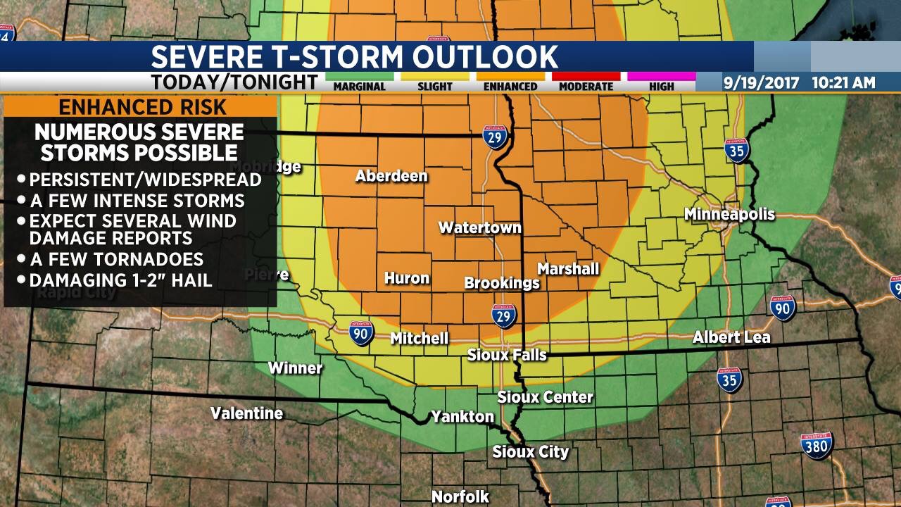
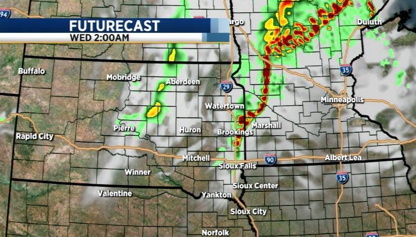
Severe Storms, Tornadoes Possible Later Today
I know it’s September, but severe storms and tornadoes are still possible this time of year and today will be one of those days.
Severe thunderstorms with the potential to produce large hail, damaging straight-line wind gusts and tornadoes will be possible later today and tonight. A couple of long-track, supercell thunderstorms are possible.
Stay weather aware today. I’ll have updates throughout the day… follow my twitter feed (@shawncable) www.twitter.com/shawncable for the latest warnings and updates throughout the day.
Sunny and Warm Today, Changes Ahead
Throw on your shorts and grab the shades! Today is going to be another sunny, warm day. High temperatures will be back in the 80s this afternoon, which is about ten degrees above average for this time of year.
A slow-moving front continues to make its way across the Dakotas and that will bring a slight chance of scattered showers and thunderstorms to Central and Northern South Dakota later today and tonight. That front will move east as we roll into the weekend, bringing showers and thunderstorms tomorrow and Saturday followed by cooler temperatures on Saturday and Sunday.
While there could be an isolated thunderstorm or two during the day tomorrow, as of right now I think the best chance of rain for Sioux Falls will be on Friday night. Central and Northeastern South Dakota will likely see scattered thunderstorms during the day on Friday with storms redeveloping Friday evening and Friday night. Some places could get one-quarter inch or more of rain. One or two storms could be severe, however the overall severe threat is relatively low.
High temperatures will drop into the 60s to low 70s this weekend, but that won’t last long. Next week will be mostly sunny with highs warming back into the 80s by Tuesday and Wednesday.
Sunny & Hot Today
The sunny, warmer than average weather pattern we’ve been enjoying for the past several days will continue through the rest of the week. Today will be sunny with high temps ranging from the upper 80s in Sioux Falls and Aberdeen to the mid 90s across central and western South Dakota.
We could catch an isolated shower or thunderstorm along and west of the James River late tonight. At this time, I don’t expect severe weather. Sunny, warm weather will continue tomorrow and Friday with a few changes rolling in by the weekend.
A cold front will slide across the region late this week, bringing a chance of showers and thunderstorms late Friday, Friday night and Saturday. Some storms could be strong to severe with the potential for heavy rain in some places. That front will also knock our temperatures back to or below average for the weekend. Highs will only reach the 60s to 70s on Saturday and Sunday.
If you’re not quite ready to let go of the summertime temperatures yet, you’re in luck. Long-range models are suggesting that highs will be back in the 80s – possibly even 90s in some places – by the middle of next week.
Both ShawnCable.com and WXLab.com are the personal websites of Shawn Cable. Shawn is a freelance meteorologist based in Sioux Falls, South Dakota.