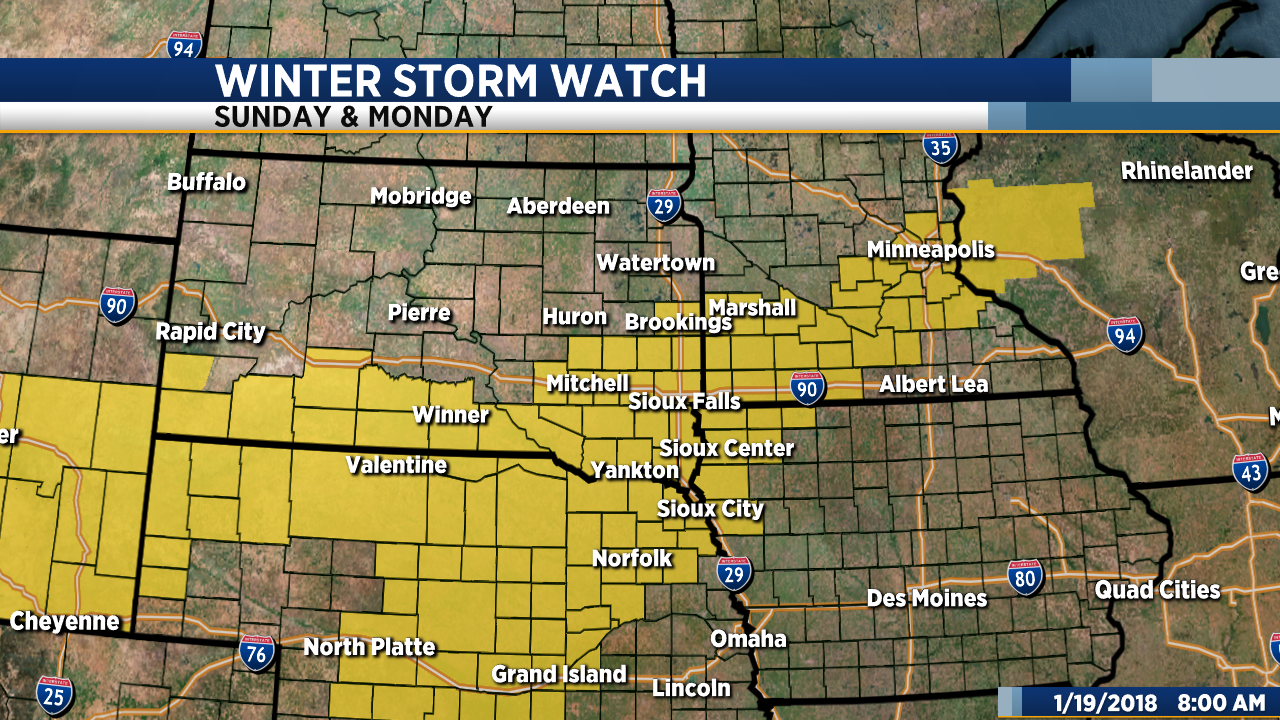
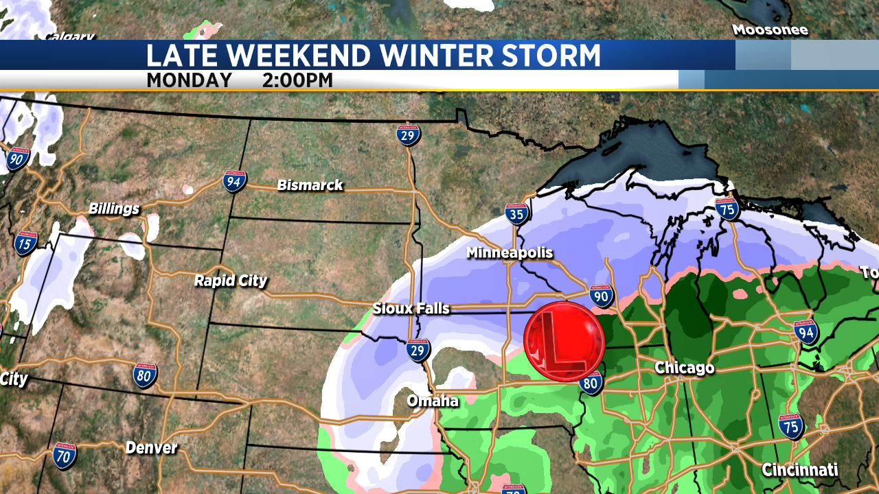
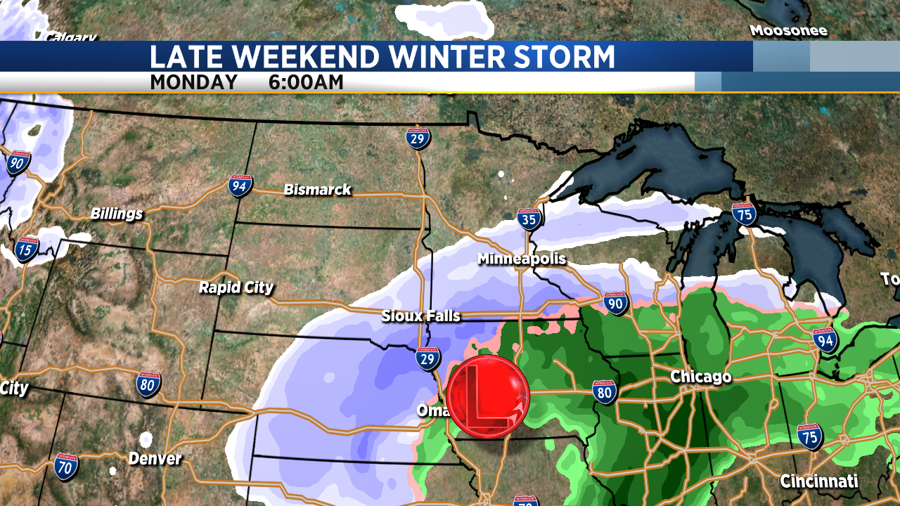
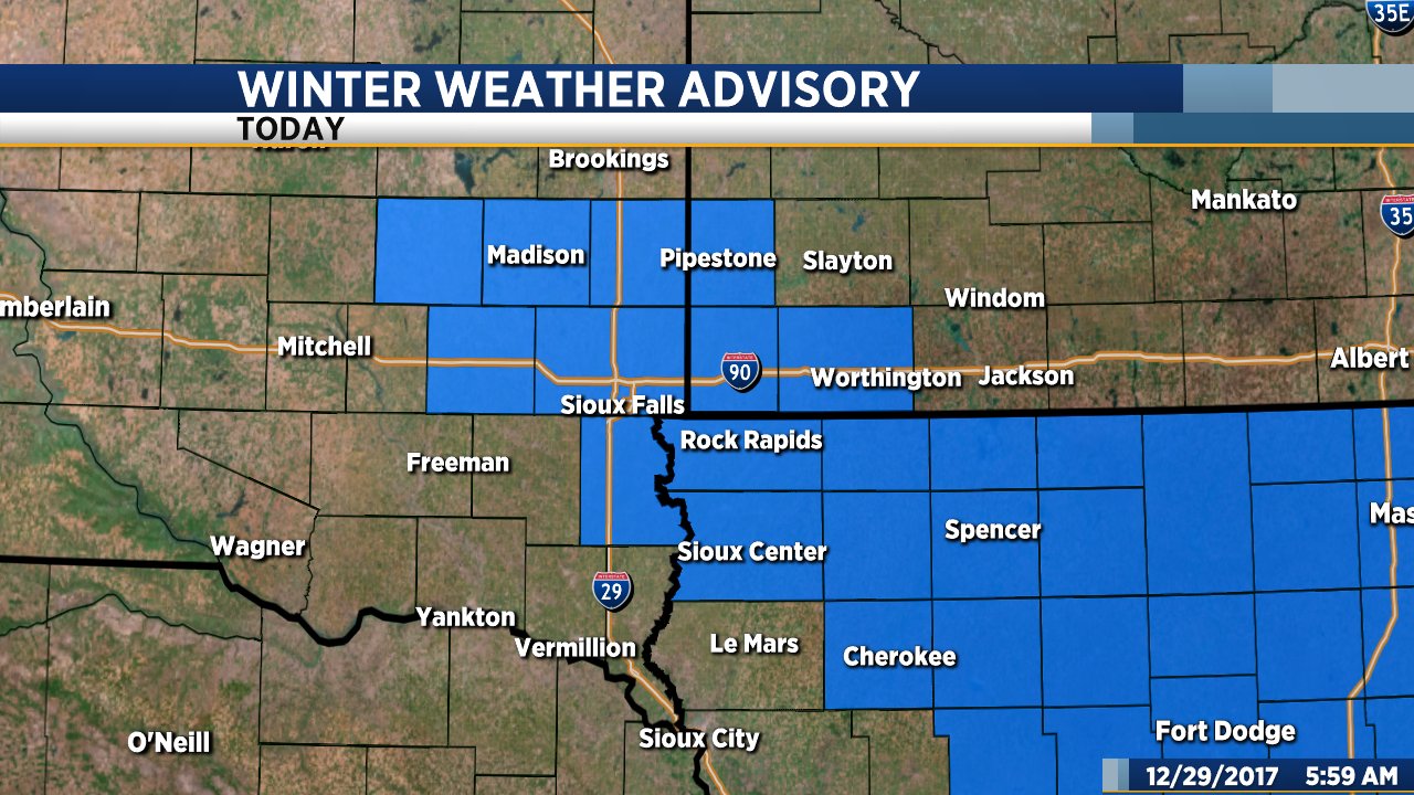
We continue to track what is looking more likely to be a fairly significant winter storm that will impact the region over the weekend. A Winter Storm Watch has now been issued by the National Weather Service and is in effect from Sunday afternoon through Monday morning.
In the meantime, we get to enjoy a couple more warm days. Today will be mostly cloudy but it will also be warmer. High temperatures will range from the upper 40s to low 50s this afternoon. Tomorrow will be a bit cooler but still mild with high temps in the low to mid 40s.
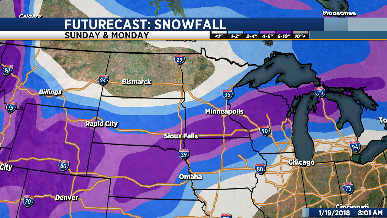
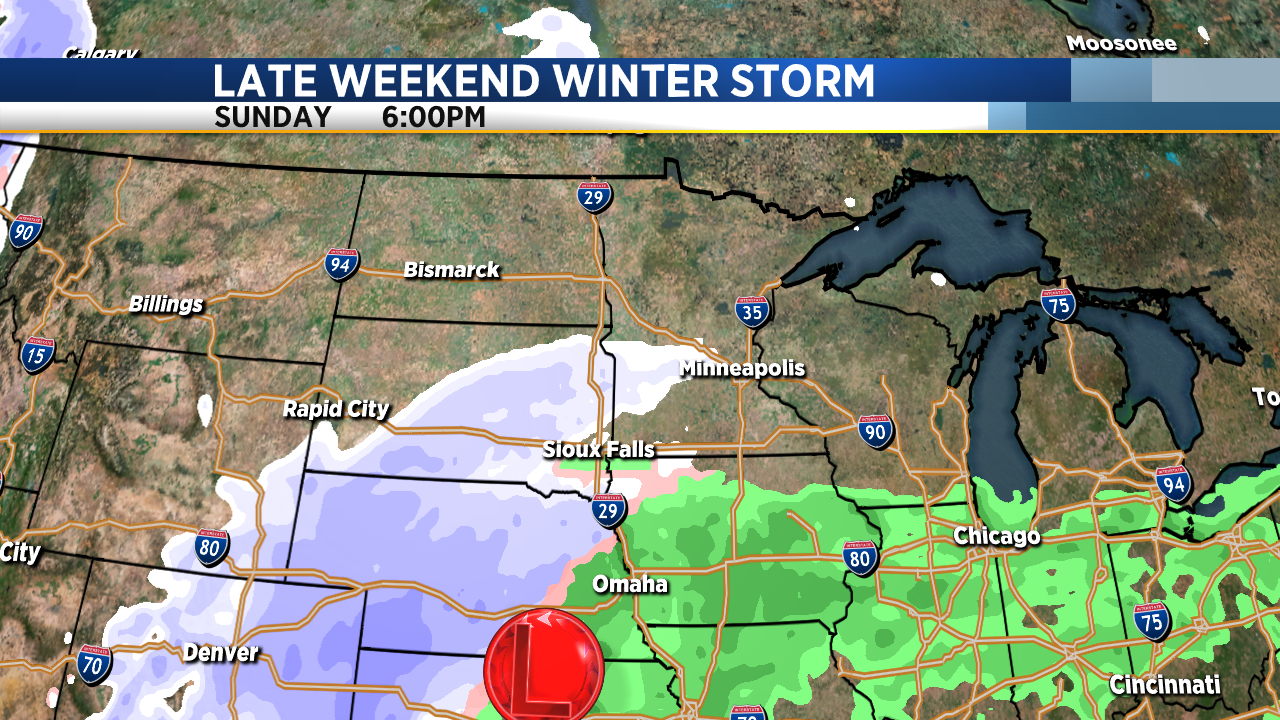
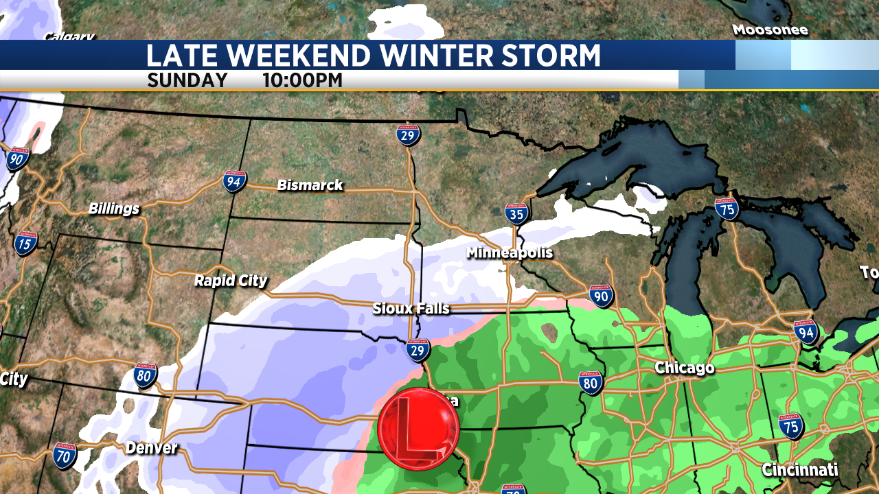
A significant winter storm system will impact our region late this weekend into early next week. As of now, it looks like the heaviest snow will fall across southeastern South Dakota, southwestern Minnesota and northwestern Iowa where 6 inches or more is possible. Snow will develop on Sunday with a brief period of rain – perhaps a little freeing rain or drizzle in some places – early in the afternoon as temperatures bump back up into the mid 30s for a short time. Snow will continue Sunday afternoon and Sunday night into Monday, becoming heavy at times. Strong northwest wind gusts will accompany the system and create areas of blowing snow late Sunday, Sunday night and well into the day Monday.
Keep in mind that the track and timing of this storm could change. Stay tuned… We will have updates as the system develops.