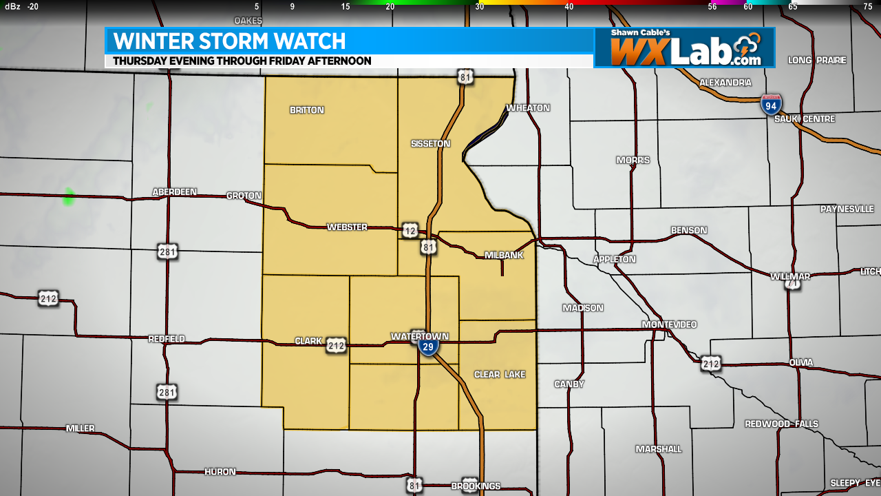
A Winter Storm Watch is in effect for NE South Dakota Thu evening thru Fri afternoon. Only about 2-3 inches of snow possible but wind gusts to 45 mph could create blizzard conditions.

Blog
A quiet weekend ahead
There will be plenty of sunshine this weekend. Saturday will be warm and breezy with highs in the 60s. Sunday will be much cooler with highs only reaching the 40s.
Strong Storms Possible in SD, MN, ND Saturday
A cold front is going to bring a change to the weather across the Northern Plains this weekend. In addition to cooler temperatures, that front could bring a few strong to severe thunderstorms to parts of Southeastern North Dakota, Northeastern South Dakota and Western Minnesota Saturday afternoon into Saturday evening. As of right now, I think the biggest severe threat will be large hail, however, strong straight-line wind gusts and locally heavy rain will also be possible.
Check my Twitter feed (@shawncable) for the latest updates and warnings as things develop on Saturday.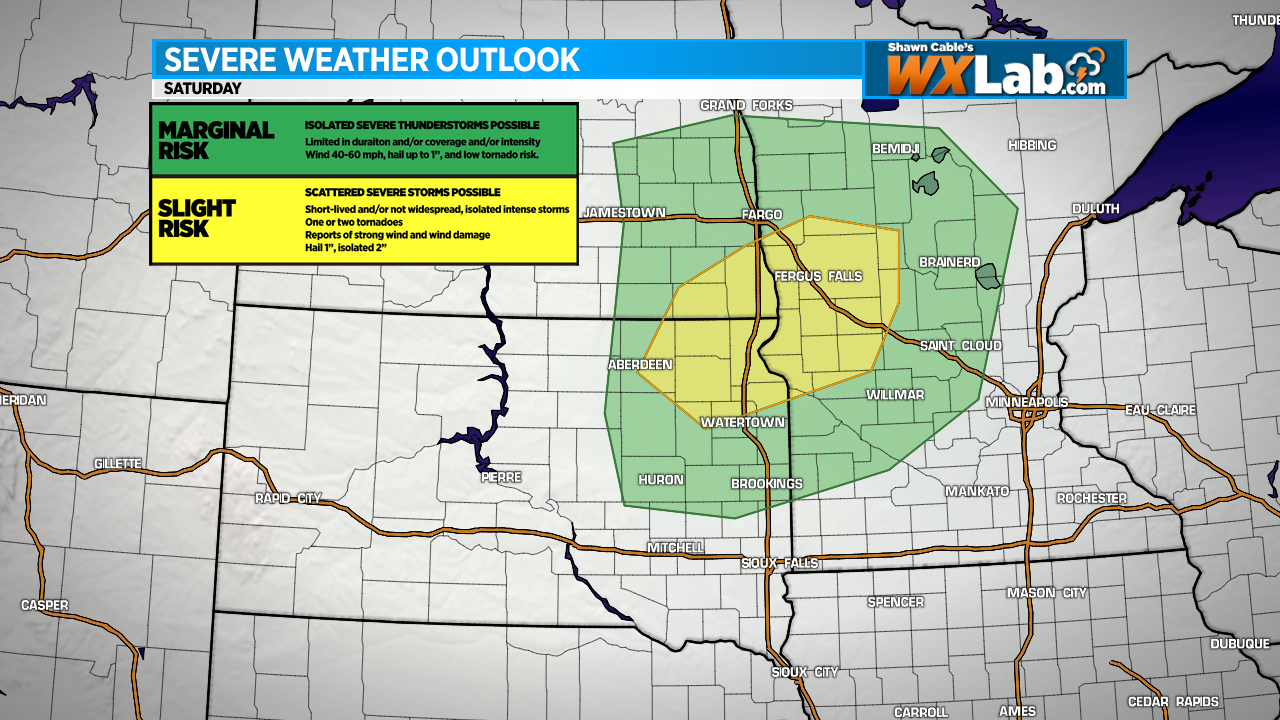
Showers Friday, Another Nice Weekend
Scattered showers will continue Friday with dry, pleasant weather throughout the weekend. High temps will be in the 70s across the Dakotas and Minnesota with 80s possible across parts of Nebraska and Iowa.
Light Snow Today, A Cold Weekend Ahead
Light snow is falling across central and western South Dakota this morning. That system will drift southeast throughout the day, bringing light snow to southeastern South Dakota and northern Nebraska. Snow accumulation of around an inch or two is possible across parts of central and south central South Dakota. In Sioux Falls, accumulation will be around a half inch or less. Snow will end and the clouds will exit from northwest to southeast this afternoon.
While light snow could make roads and sidewalks slippery at times today, the most noticeable change in our weather will be the temperature. A cold front blasted across the plains yesterday and temperatures have been falling ever since and will continue to fall through the day today. Today’s high will be in the teens this morning with temps falling into the single digits this afternoon. Wind will be from the north at about 10 to 20 mph and that will keep the wind chill factor below zero for most of the day.
Tonight will be clear and cold. The low will drop to around 5 below zero in Sioux Falls with parts of northern South Dakota dropping to near 20 below zero by tomorrow morning. Saturday will be sunny with high temps only reaching the single digits to low teens.
A little light snow is possible on Sunday with temperatures bouncing back into the 20s on Sunday and Monday. After Monday, another Arctic air mass will plow across the plains and this one will be even colder than the one today.
Bundle up and have a great weekend!
Both ShawnCable.com and WXLab.com are the personal websites of Shawn Cable. Shawn is a freelance meteorologist based in Sioux Falls, South Dakota.