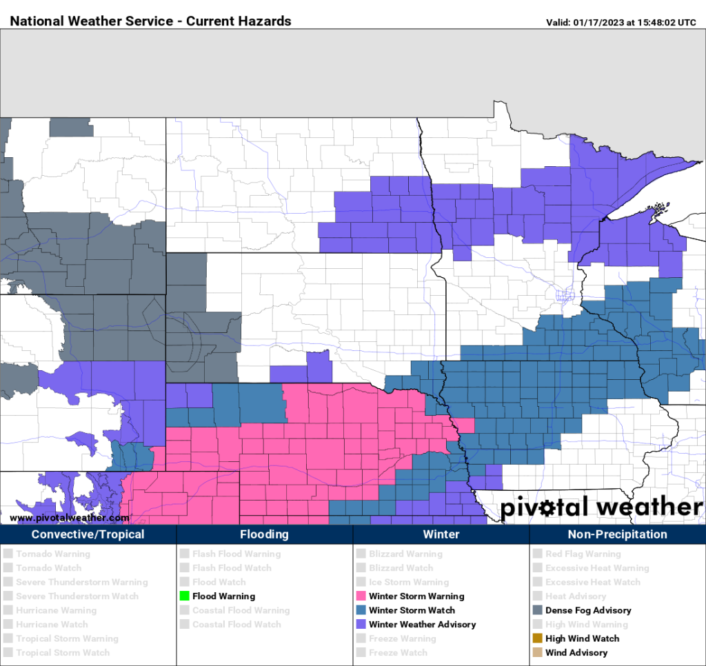
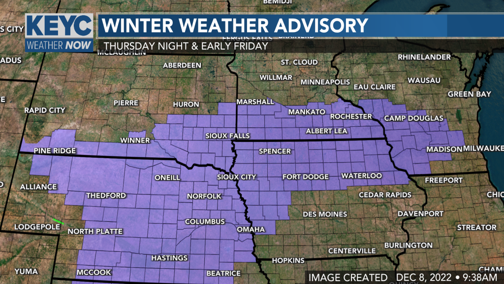
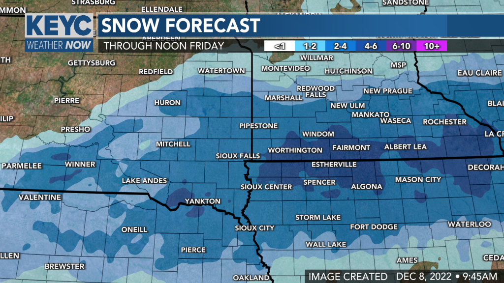
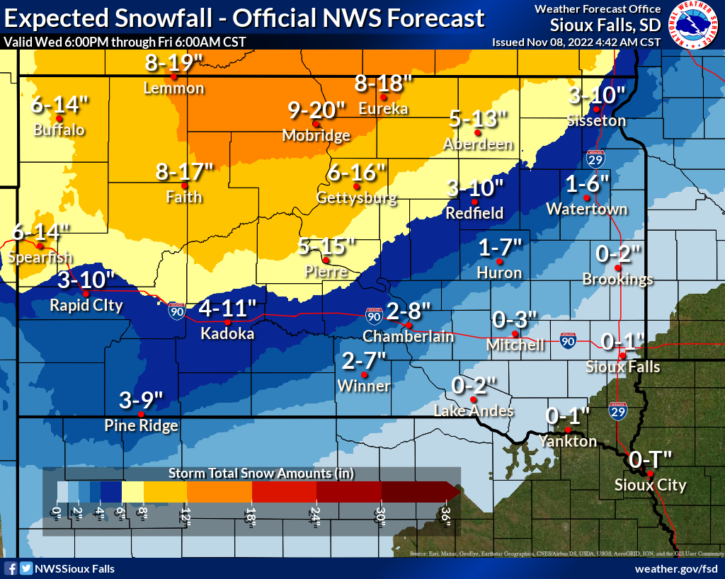
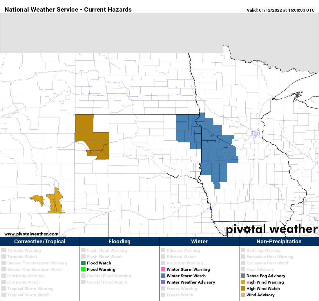
Rain, freezing rain and snow this week

Get ready for a wild week of weather! A powerful and slow moving storm system will bring all types of winter precipitation in multiple waves starting late tonight and continuing through Friday, possibly into Saturday.

A winter weather advisory is an effect for the Sioux Falls area through this afternoon and tonight into Tuesday morning. Areas of freezing rain, sleet and snow will be mixed with rain. Icing is possible with a half inch to an inch of rain possible through Tuesday morning. By late Tuesday, rain will change to light snow which will continue through Wednesday and Thursday into early Friday.

Snow, freezing rain Thursday night into Friday

A winter storm system will bring areas of snow and freezing rain to southeastern South Dakota, southern Minnesota and northern Iowa late Thursday, Thursday night and early Friday. Snowfall amounts will generally be in the 2 to 4 inch range with a swath of slightly higher amounts possible along I-90. There won’t be much wind with this system, so blowing snow will not be an issue. There will, however, be periods of freezing rain or drizzle with the snow and that will make roads and sidewalks very slippery. Snow will end from west to east Friday morning. A Winter Weather Advisory is in effect from late Thursday into Friday morning.

Tracking late week winter storm

A Winter Storm Watch is in effect for late Thursday through Friday night and includes parts of eastern South Dakota and western Minnesota. We are watching a late week winter storm system that could bring 4-8 inches of snow to eastern South Dakota and western Minnesota this Thursday night through Friday. In addition, strong wind gusts of 25-35 mph on Friday afternoon and night could create areas of blowing and drifting snow. Stay tuned for updates.