Winter storm update
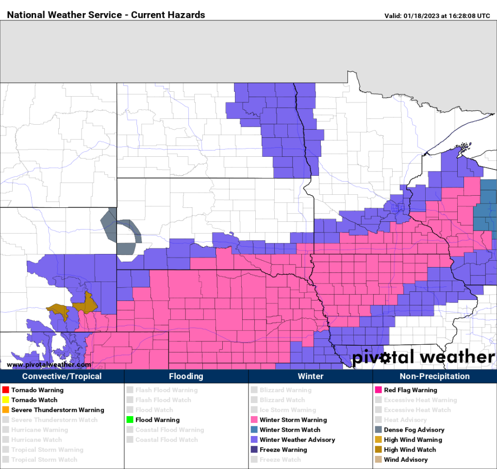
Here are the latest warnings and advisories. Snow will start across far southeastern South Dakota by mid to late afternoon and develop north to I-90 across eastern South Dakota and southern Minnesota by 6pm ish and continue further north into this evening. We’re looking at about 4 to 7 inches along a line from Sioux Falls to Mankato to the southern edge of the Twin Cities. Amounts will be heavier to the south. As of now, I’m thinking around 4 to 6 inches Sioux Falls, 8 to 12 inches in the Sioux City, Yankton, Vermillion area, 5 to 7 in the Mankato area. There will be a sharp cutoff to the north, So if this system drifts any further south those numbers could be lower. If it drifts north, those numbers could be higher. But as of now, The system has been trending just slightly south. The snow will come in a relatively short time frame, so when it is snowing it will come down heavily. That will cause problems with visibility and roads will quickly become snow covered. Wind gusts of 25 to 35 mph will be possible to cross far southwestern Minnesota, far northwestern Iowa, South Dakota and Nebraska.