A Winter Storm Watch is in effect for late Thursday through Friday night and includes parts of eastern South Dakota and western Minnesota. We are watching a late week winter storm system that could bring 4-8 inches of snow to eastern South Dakota and western Minnesota this Thursday night through Friday. In addition, strong wind gusts of 25-35 mph on Friday afternoon and night could create areas of blowing and drifting snow. Stay tuned for updates.
Daily Weather Discussion
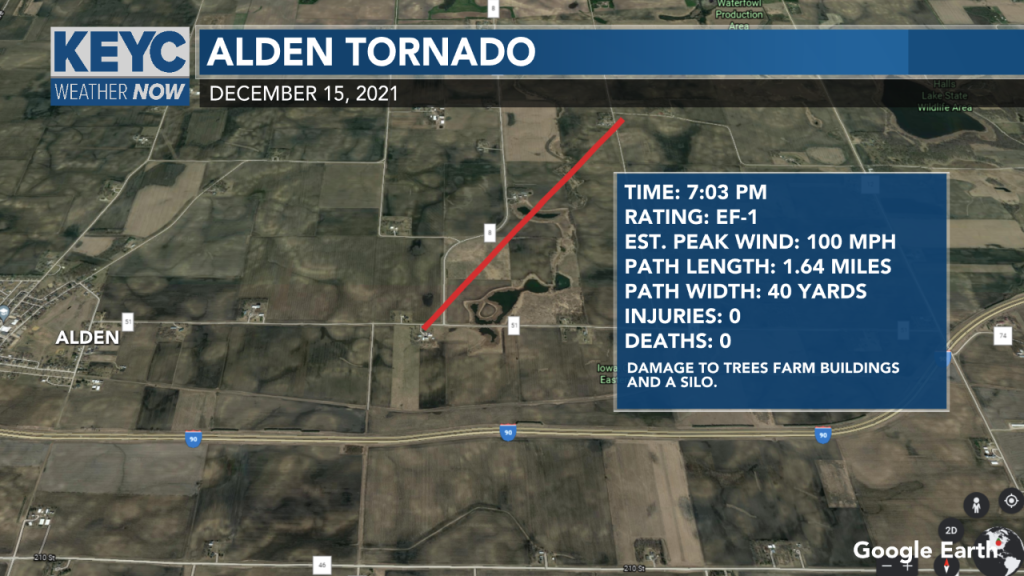
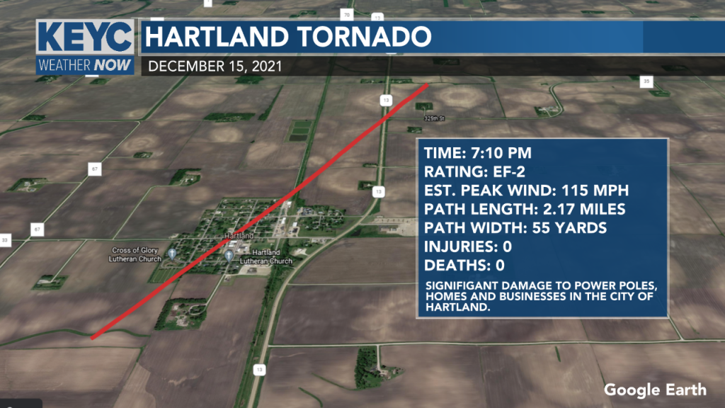
First Ever Tornadoes in Minnesota in December
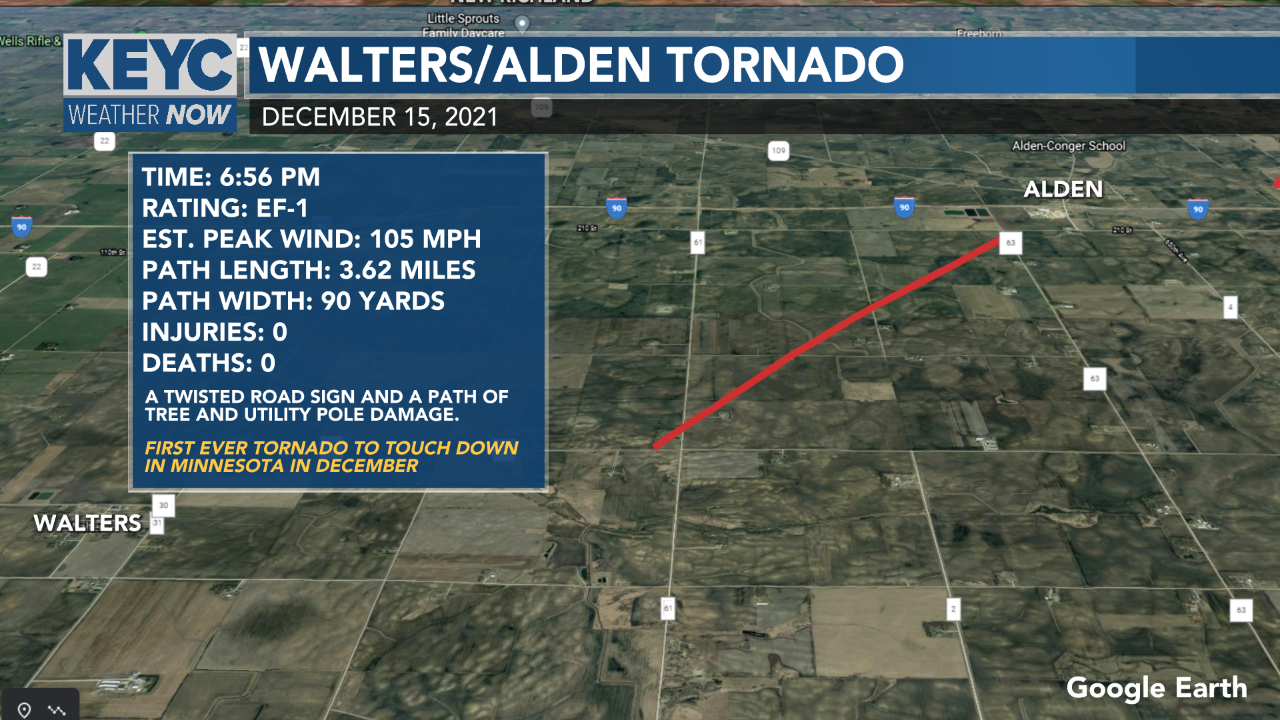
On December 15, 2021, for the first time ever, tornadoes touched down in Minnesota. These were the first three.
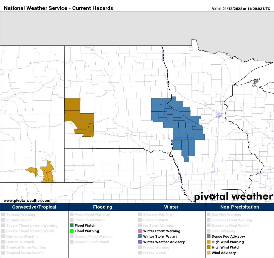
Winter Storm Update
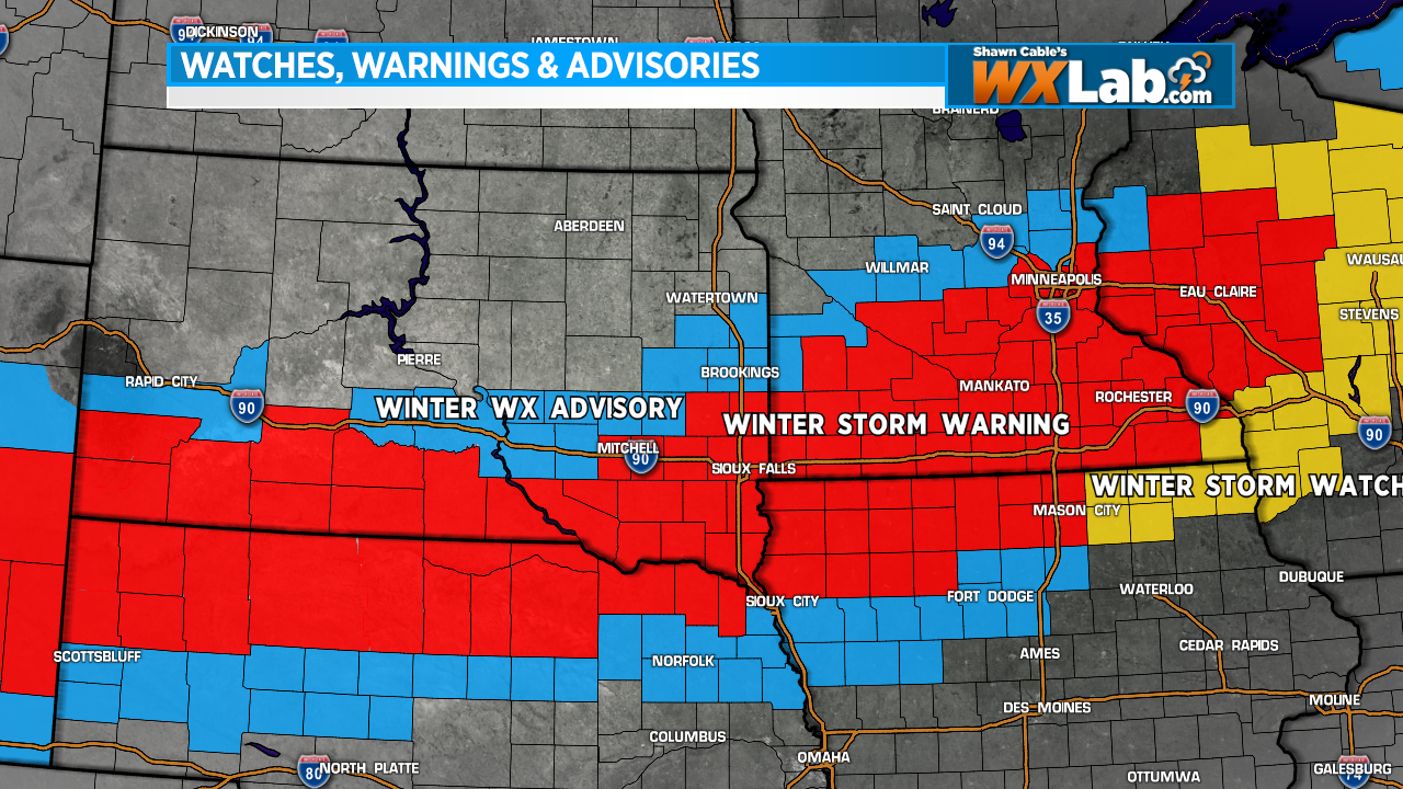
WINTER STORM WARNING is now in effect for places in RED. 6-12 inches of snow is possible in these areas. Snow will start across southern SD and northern NE on Thursday night and move into IA and MN Friday morning. The system will move out late Friday night.
Here are some projections:
Sioux Falls: 5-9″
Yankton/Vermillion: 4-8″
Mitchell: 4-8″
Chamberlain: 3-6″
Brookings: 3-6″
Watertown: 1-3″
Pierre: 1-3″
Mankato: 5-9″
Twin Cities: 2-6″
Winter Storm will Impact Region on Friday
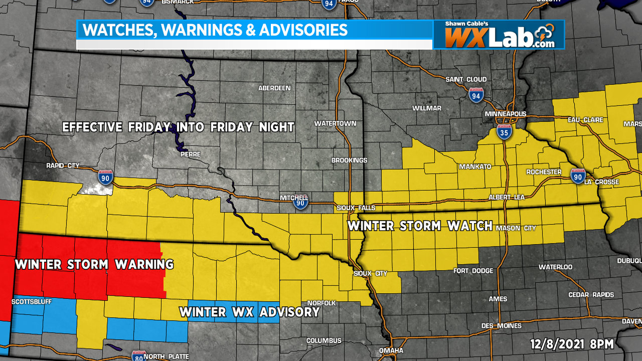
We are tracking a winter storm system that could bring significant snow to parts of our region Friday, Friday night into Saturday. A Winter Storm Watch has been issued by the National Weather Service for much of Southern, South Dakota, Northern Nebraska, southern Minnesota and northern Iowa Friday afternoon into Saturday morning. 4 to 8 inches of snow is possible in the Watch area
This system is still a couple days away. As it develops and we get a better idea as to where this storm will track, we will likely make changes and adjustments to our snow forecast. Stay tuned for updates.
A Bonus “Nice Day” Tuesday
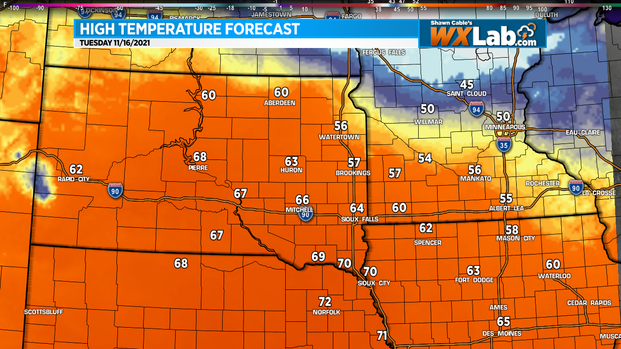
If the snow, wind and cold the past few days has brought on feelings of guilt and regret… You know, all of those outdoor things that you had intended to do… Clean the garage. Rake the leaves. Take down the trampoline. I could go on and on.
You can feel a little better because we’re going to get a bonus day this week. Tuesday. Highs will climb into the 50s and 60s with a few places reaching 70 degrees. It will be a bit breezy, bit it will be warm.
Don’t waste it because it’s only gonna last a day. Highs will drop back into the 30s and 40s by Wednesday and stay there for a while.
Both ShawnCable.com and WXLab.com are the personal websites of Shawn Cable. Shawn is a freelance meteorologist based in Sioux Falls, South Dakota.