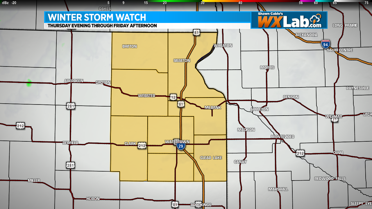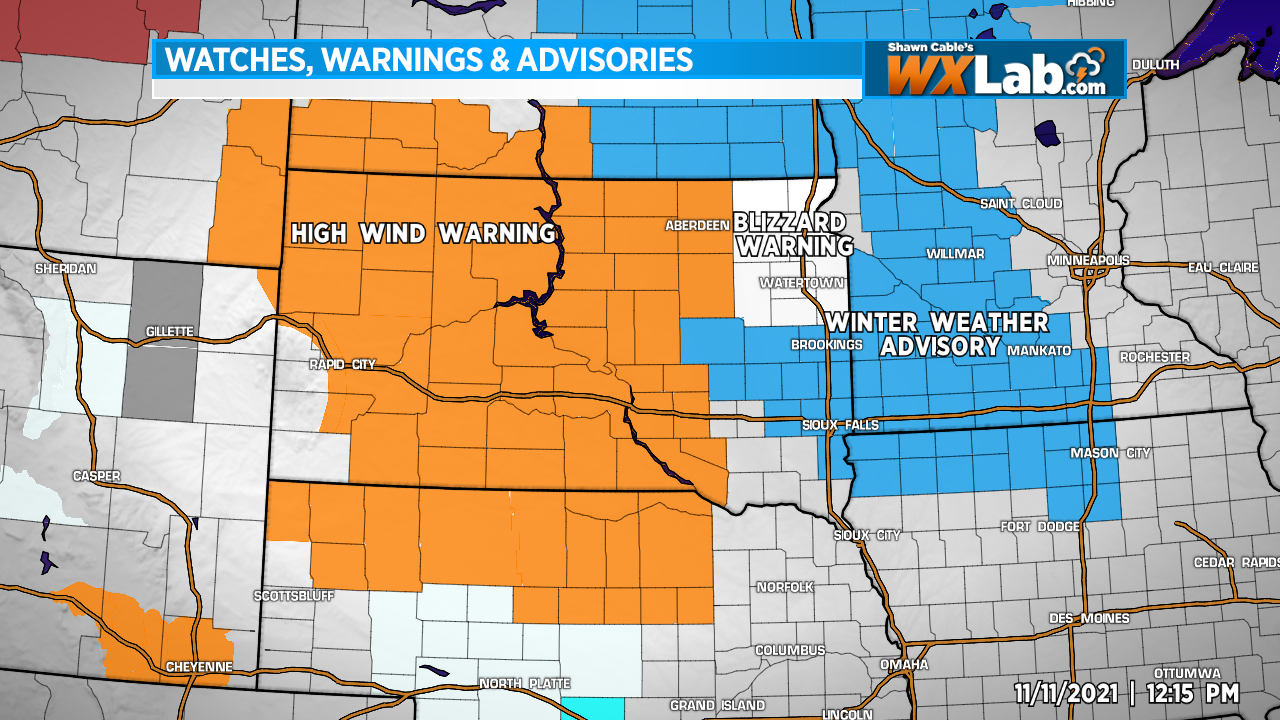
There is a lot going on across the Northern Plains today. High Wind Warnings are in effect across the Dakotas and Nebraska today into tonight. A Blizzard Warning is in effect for northeastern South Dakota this evening through Friday. A Winter Weather Advisory is in effect for parts of eastern and southeastern South Dakota, western and southern Minnesota, and northern/northwestern Iowa from later today and tonight through Friday.
The wind has already gusting to 60 between 60 and 70 mph along and west of the Missouri River today. Wind gusts will increase from west to east throughout the day today and into tonight. Snow will develop late today into this evening across the eastern Dakotas and move into Western Minnesota and Iowa by mid to late evening. The snow will not be terribly heavy. Around an inch or two is possible with heavier amounts in the 3-5 inch range across northeastern South Dakota and western Minnesota, but with wind gusts to between 50 and 60 mph, it won’t take much to create blowing snow and blizzard conditions that could reduce visibility to near zero at times.
Travel conditions would likely be fairly rough this evening through much of Friday. Conditions will gradually improve from west to east during the day Friday.
If you can avoid travel, that would be great. If you must travel, make sure you have a full gas tank and plenty of warm clothes and blankets in the trunk just in case.